
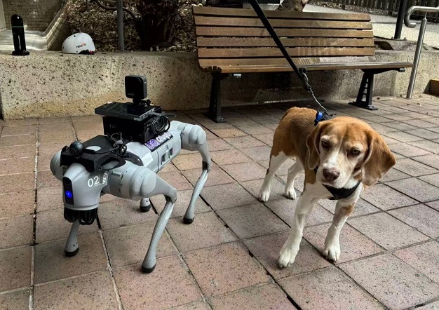
Researchers at the University of Queensland’s VisLab are testing a robotic dog to map campus pathways and evaluate accessibility routes. The project explores how advanced spatial capture technologies and autonomous robotics can be integrated for infrastructure planning.
Testing QiuQiu on Campus Trails
The initial trial utilized a Unitree Go2 quadruped robot nicknamed QiuQiu, provided by Dr. Thien-Minh Nguyen. During the test, QiuQiu navigated a roughly 790-metre accessibility route between the VisLab and the UQ St Lucia campus ferry terminal in approximately 13 minutes.
The multidisciplinary research team—including Dr. Jurij Karlovsek, Associate Professor Fred Fialho Teixeira, Dr. Qianbin Xu, Dr. Thien-Minh Nguyen, Dr. Tyson Phillips, Rui Zhang, and Mohan Ren—combined the robot's internal motion data and onboard cameras with a 360-degree camera. They compared this automated collection method against traditional handheld LiDAR scanning along the same path.
As the robot walked, it recorded its pose, orientation, and odometry while utilizing LiDAR to measure changing slopes and terrain. Early data analysis indicated a mostly gentle route featuring a net fall of about seven metres, a short ramp near the start, and a gradual descent.
Project organizers note that the measurable spatial data gathered during these trials could ultimately feed into the ongoing development of the UQ St Lucia Campus Digital Twin. By integrating route geometry and mobility metrics into an interactive model, the initiative aims to enhance universal access analysis and support future campus planning.